Is the Ring of Fire Waking Up? Quakes, Eruptions, and the Deep Breath of the Planet
Updated October 19, 2026. The dated events below are historical examples, with a separate October 2026 reporting snapshot; this article is not an emergency bulletin.
A map of earthquakes around the Pacific can look like somebody outlined an ocean with warning lights. Then a volcano sends ash into the sky, a tsunami alert reaches another coast, and the phrase “Ring of Fire” starts sounding alarmingly literal. I understand the urge to connect every flashing dot. Give my brain three dramatic headlines and it will try to organize a planetary group chat.
The geology deserves a closer look. The Pacific's margins contain many active faults and volcanic regions, but a collection of events does not establish that the whole belt is entering a newly intensified phase. Local danger can be serious while a claim about a worldwide surge remains unsupported. Both the scale of the hazard and the scale of the evidence matter.
That is where I want to begin: with the Earth we can investigate. There is plenty of wonder in a planet whose surface moves, folds, sinks, and occasionally opens. We can keep the deep breath as a metaphor while asking what the instruments actually recorded.
A ring on the map, many systems underneath
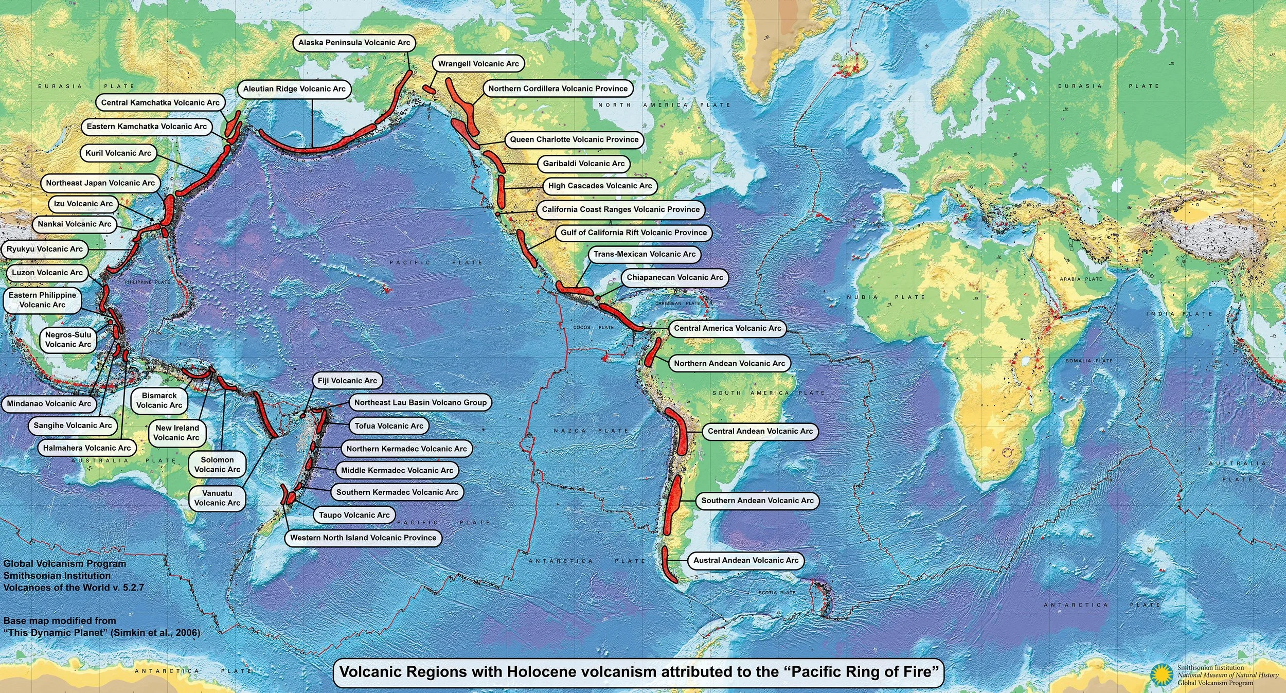
The Ring of Fire is a popular geographic description rather than one continuous geological structure. The Smithsonian's Global Volcanism Program emphasizes that its regions have different tectonic settings and that adjacent volcanoes do not share a connected magma reservoir. There is no single underground plumbing system linking every smoking summit around the ocean.
Even the label's boundaries vary. The program's explicitly defined map excludes Hawaii's hotspot volcanoes and most Indonesian volcanoes, while broader popular accounts often include Indonesia. That does not diminish Indonesia's volcanic hazards. It means a statistic about the “Ring” needs a definition before it becomes useful. A familiar name can conceal several different outlines.
Subduction helps explain many of these landscapes. An oceanic plate descends beneath another plate, carrying water-bearing material downward. Water released from the descending slab helps lower the melting temperature of rock in the overlying mantle, allowing partial melting. Magma can then rise and accumulate. Water released at depth becomes part of the explanation for a mountain that erupts into the sky.
The same broad tectonic setting can produce large earthquakes along a plate boundary and volcanoes farther inland, but those are different processes. Sharing a geological neighborhood does not make every event a direct cause of the next. The map gives us a starting point; the details beneath each location do the explaining.
Map: Smithsonian Global Volcanism Program, Pacific Ring of Fire regional map (2025 version), shared under CC0. Its highlighted regions follow the program’s stated definition; the map does not show current alerts or a connected magma system. Map source and definition.
Kamchatka: a great earthquake with a specific history
The magnitude 8.8 earthquake offshore Russia's Kamchatka Peninsula occurred on July 29, 2025, in UTC, which was July 30 locally. USGS described it as tied for the sixth-largest earthquake recorded by modern seismic instruments. It prompted tsunami watches and warnings across the Pacific. This was an extraordinary event without requiring a story about the entire ocean's margins waking together.
The USGS account also places it within an active regional sequence that included a magnitude 7.4 earthquake on July 20. That context matters because a list of shaking events can include related earthquakes in the same sequence. Counting every entry as a separate sign of global escalation would confuse the local sequence with the larger question.
Aftershocks deserve attention in their own right. A mainshock does not mean the affected area has finished shaking, and a reassuring sentence about the biggest danger being over can leave the wrong impression. The practical information is in the relevant aftershock forecasts, local instructions, and damage assessments, with their dates clearly attached.
For me, the important perspective is that a major event has several stories at once: the rupture itself, the continuing regional consequences, and the ocean's response. Keeping those stories distinct helps explain why a place far from the epicenter might receive a warning without experiencing the same shaking.
A tsunami begins with a disturbance that displaces water, often a large earthquake near or below the ocean floor. Waves can cross deep water quickly and change as they reach shallower coastal areas. The earthquake magnitude alone is therefore not a complete description of the consequences at every shore.
Nor is a tsunami necessarily one enormous breaking wave. It is a series of waves, and dangerous currents are part of the hazard. The first arrival does not establish that the event has ended. That is another reason current local instructions matter more than a dramatic image circulating online.
Klyuchevskoy was already erupting
The nearby volcano offered a particularly tempting narrative: a great earthquake, then a mountain answering with fire. But the Smithsonian/USGS report for late July 2025 says lava had been filling Klyuchevskoy's crater since April 20. It describes the magnitude 8.8 earthquake as unrelated to the ongoing eruption. The eruptive sequence was already underway well before the quake.
That chronology changes the meaning of the images. An erupting mountain seen after an earthquake does not establish that the earthquake started its eruption. Looking backward through the monitoring record is essential. Otherwise, the moment a spectacular picture reaches our screen can quietly become the moment we imagine the geological process began.
There is room for real interaction. USGS explains that some large regional earthquakes may trigger unrest or an eruption at a nearby volcano already poised to erupt, with suitable magma and pressure conditions. That is a conditional physical possibility, not a rule that every strong earthquake summons an eruption. An explanation should match the evidence for the particular volcano.
I still find the juxtaposition astonishing. The wonder survives the correction quite comfortably. In fact, a crater filling over months gives us a richer story than a mountain apparently taking instructions from the latest headline.
Eruptions have dates, heights, and reference points
Kanlaon in the Philippines and Lewotobi Laki-laki in Indonesia produced serious events in 2025. Their reports illustrate why precise descriptions matter. PHIVOLCS recorded a moderately explosive eruption at Kanlaon on May 13, lasting about five minutes, with a plume approximately 4.5 kilometers above the vent. That measurement should retain its reference point when it is repeated.
For Lewotobi Laki-laki, the Smithsonian/USGS report, drawing on Indonesia's volcanic agency, describes the July 7 eruption's plume reaching around 18 kilometers above the summit and pyroclastic flows descending as far as five kilometers. These are different measurements of different hazards. A plume's height cannot tell us the reach of material traveling along the ground.
There is also a current, dated reporting context. The weekly Smithsonian/USGS report for October 8–14, 2026 described continuing lava effusion at Alaska's Great Sitkin. It also documented continuing activity at Kanlaon, including an October 10 eruption with a plume five to six kilometers above the summit. These observations describe particular systems during a particular week; they are not a forecast for every Pacific coast.
A report can be useful precisely because it is specific. Which volcano? Which instrument or observation? Above the vent or above sea level? New activity or a continuing eruption? Those small questions keep an impressive number attached to the thing it actually measures. They also help prevent an old photograph or bulletin from becoming an apparent update simply because somebody reposted it.
Can earthquakes affect places far away?
Sometimes they can. USGS describes dynamic triggering, in which passing seismic waves from a large earthquake can promote earthquakes in susceptible locations at a distance. So the blanket statement that earthquakes cannot influence distant regions is too strong. The Earth transmits waves, and faults can respond.
The next step requires evidence, however. Events occurring close together in time do not automatically demonstrate triggering. A proposed link needs a physical explanation and an analysis of the observations. “Possible in principle” and “shown in this case” carry different amounts of information. I want those words to keep their jobs.
This distinction matters especially when a news feed jumps from Russia to California, the Philippines, and Italy. A sequence assembled by an editor is not necessarily a sequence produced by a single mechanism. We can acknowledge genuine interactions while still asking whether the particular chain being proposed has been demonstrated.
What the longer record can tell us
USGS notes that temporary rises and falls in earthquake activity are part of normal variation. Improvements in instrumentation also increase the number of recorded earthquakes, while faster communication makes distant events easier to learn about. A busier catalog or a more crowded feed therefore needs interpretation before it becomes evidence of a changing global rate.
The volcanic record has similar complications. The Global Volcanism Program describes how expanding observations, satellite monitoring, and more systematic reporting have increased the documentation of eruptions. Comparing an era with sparse observations to one with extensive monitoring can create an apparent trend partly driven by the record itself.
A fair comparison needs a defined region, time interval, and kind of event, with attention to how consistently events were detected. An eruption already underway is also different from an eruption that began during the period being counted. Without those choices, “more active” can mean several different things.
I find this reassuring in a very particular way. It gives us a method for checking an alarming claim. It does not erase the consequences of a damaging earthquake or an eruption near a community. A long-term pattern and a local emergency answer different questions, and people deserve useful information about both.
Cascadia deserves preparation without a countdown
The Cascadia subduction zone is a serious hazard along the Pacific Northwest. Research using Japanese tsunami descriptions and geological evidence supports an approximately magnitude 9 earthquake there in 1700. The evidence for that event reaches across an ocean and through centuries, which is remarkable scientific detective work.
That history supports planning for future earthquakes and tsunamis. It cannot give the next rupture an appointment time. A long-term probability also needs its magnitude threshold, geographic extent, model, and time window. A percentage quoted without those details can sound precise while telling readers surprisingly little about what was estimated.
I would approach tsunami scenarios with the same care. Wave height at a gauge, the elevation water reaches on land, and flood depth at a particular building are different quantities. A dramatic number detached from a location and model can misrepresent the hazard. Local inundation and evacuation maps are much more useful for deciding where to go.
Depth matters as well. A deep-focus earthquake hundreds of kilometers down is different from a shallow rupture near the seafloor, and large deep earthquakes can still be felt over substantial distances. “Deep” does not mean “silent slip.” Slow-slip events describe a different style of fault movement, releasing motion gradually with little or low-frequency seismic radiation. Those terms should explain the process rather than decorate a frightening paragraph.
The monitoring work behind a useful warning
Volcano observatories combine observations such as earthquakes, ground deformation, gas emissions, and satellite measurements. USGS emphasizes the value of continuous measurements and multiple kinds of data. A change becomes more meaningful when scientists can compare it with the volcano's own background behavior and past events.
That baseline is one reason quiet periods matter. Instruments maintained when a mountain looks uneventful can help identify an important change later. Eruption forecasts can also develop as unrest or an eruption unfolds, with several possible outcomes rather than a guarantee of one exact result.
I appreciate this less theatrical side of the story: the station that keeps operating, the measurement checked against yesterday's, the person explaining what remains uncertain. Those efforts can look modest beside a photograph of lava, but they are part of how an observation becomes information a community can use.
Let curiosity lead to a practical plan
For a coastal resident or traveler, local guidance belongs near the beginning of the conversation. NOAA recommends knowing the tsunami hazard zone and evacuation routes, practicing the route, planning communication, and having several ways to receive official warnings. A hotel or campground can help visitors find local safety information.
Natural warnings matter too: strong or long shaking, an ocean roar, or unusual ocean behavior. NOAA says people in a tsunami hazard zone experiencing a natural warning should act without waiting for an official alert. During shaking, drop, cover, and hold on; as soon as movement is safe, follow evacuation routes toward high ground or inland. Stay out of the hazard zone until officials say it is safe to return. On a beach or near the water, even an earthquake of any size and duration is reason to move promptly to safety once you can do so.
An online article should help somebody find the right local instructions before an emergency. I would rather know the route while I have time to ask sensible questions than discover it while my phone is trying to load a map and my nerves have become the project manager.
The Pacific's restless margins definately deserve our attention. I want to keep looking closely, learning the names of places and the processes beneath them, while leaving room for what the evidence has yet to resolve. The deep breath of the planet is a lovely image. The care we bring to living here can be something wonderfully concrete.
Related Reads You Might Enjoy
The Plants That Predict Earthquakes: Is Nature Trying to Warn Us?
When the Moon Rang Like a Bell: NASA’s Apollo Mystery That Still Echoes
Where the Universe Hides Her Skeleton: The Tale of Missing Matter
The Blood Falls of Antarctica: Why a Glacier Is Bleeding from the Ice
The Earth’s Core Is Leaking Gold: A Hidden Alchemy Beneath Our Feet
How Do Auroras Form? A Dance of Solar Fire and Magnetic Veils
Sources and further reading
Smithsonian GVP: what the Pacific Ring of Fire means, regional boundaries, and map license
USGS: how water released during subduction helps mantle rock melt
USGS: July 2025 Kamchatka earthquake and aftershock sequence
Smithsonian/USGS: Klyuchevskoy report, July 23–29, 2025, and its earlier eruption chronology
USGS: conditions under which earthquakes can trigger volcanic eruptions
Smithsonian GVP: interpreting the historical eruption record
Satake, Wang, and Atwater: reconstructing the 1700 Cascadia earthquake from tsunami descriptions
NOAA: tsunami preparation, natural warnings, and safe response
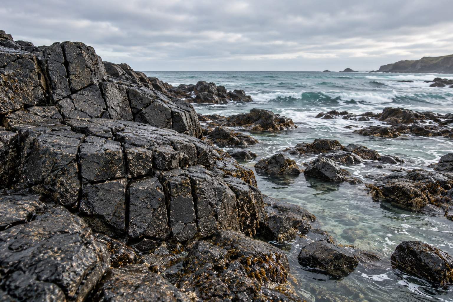
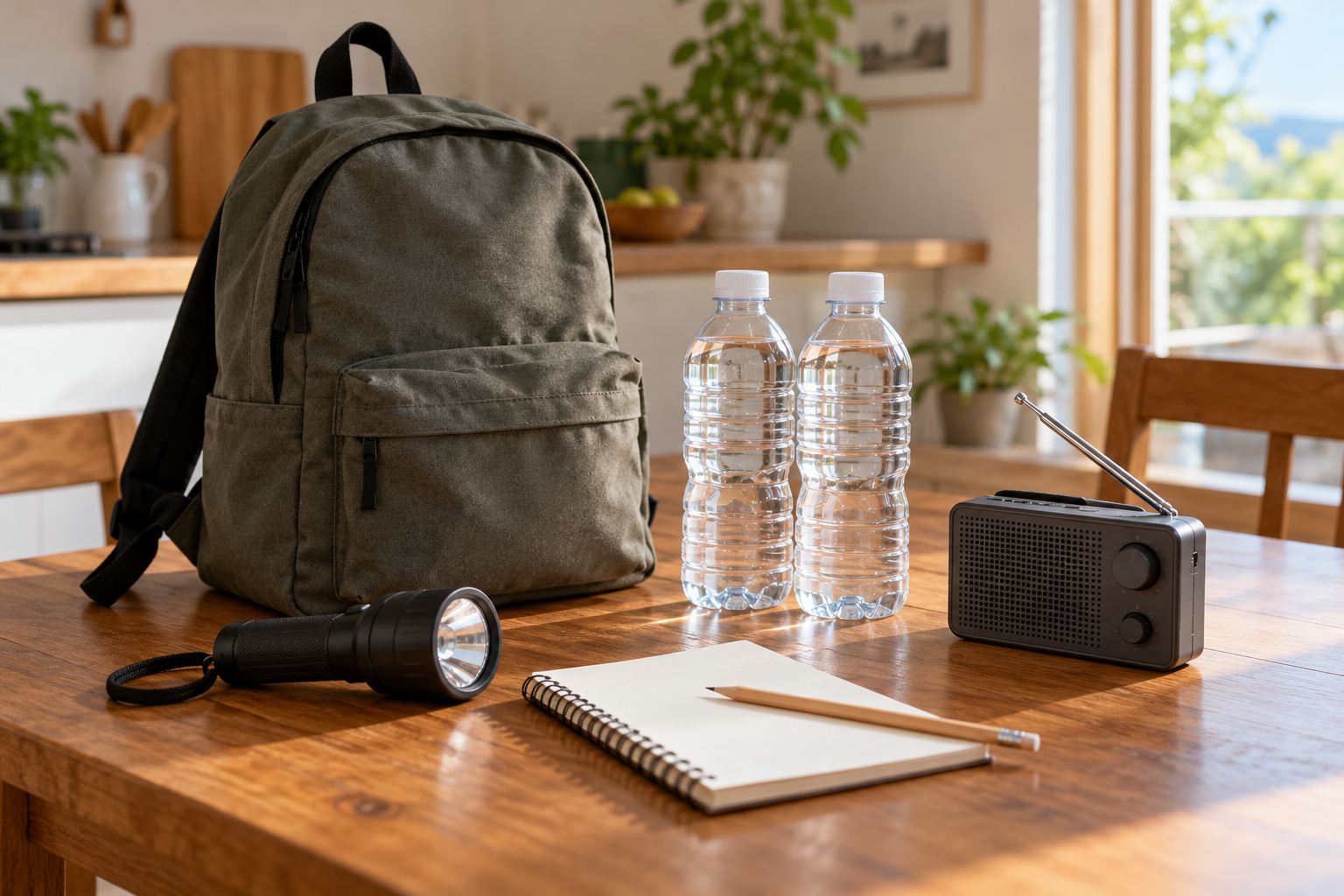
The landscape, rock, and preparedness scenes are AI-generated editorial illustrations, not event photographs or a complete emergency-kit checklist. The geographic map is credited separately above.